Here we tell you everything you need to know to walk the Portuguese Coastal Camino de Santiago, with tips, practical information, and our own experience.
This section of the Camino de Santiago is still not very well known among tourists, even though the landscapes are truly stunning.
It is one of the many routes across Europe that lead to Santiago, where the Apostle awaits the pilgrim and offers his blessing.
In this article, we’ll share our experience walking the Portuguese Coastal Camino de Santiago from A Guarda to Pontevedra, where it connects with the Traditional Portuguese Camino de Santiago.
This time, we didn’t walk the entire Camino but only a section of it. We didn’t have the goal of reaching Santiago de Compostela, since we had already been there before, both as visitors and at the end of the Camino.
We already have two Compostelas, the diplomas you receive certifying that you’ve completed all or part of the Camino.
In summary, on this trip we walked the following stages of the Portuguese Coastal Camino de Santiago:
- Stage 1 – from A Guarda to Mougás
- Stage 2 – from Mougás to Ramallosa
- Stage 3 – from Ramallosa to Vigo
- Stage 4 – from Vigo to Redondela
- Stage 5 – from Redondela to Pontevedra
From here, there are approximately 3 more stages left to reach Santiago, when it connects with the traditional Portuguese Camino de Santiago.
From A Guarda to Mougás – Stage 1
Ferry across the Miño River
If you’re coming from Portugal, you’ll need to cross the Miño River by ferry, from the town of Caminha in Portugal to A Guarda in Spain. There are several services per day.
Visit the Castro de Santa Tecla
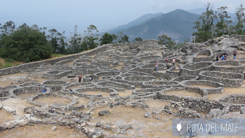
This visit to the Castro de Santa Tecla is a small detour from the Camino de Santiago, but it’s well worth it, both the detour and the steep climb on foot. It’s 341 meters to the top of the hill.
Santa Tecla (or Santa Trega in Galician) is an archaeological site with the remains of a Celtic fortified settlement prior to the Roman period, known as a castro, along with petroglyphs over 2000 years old.
We were able to see some of the typical circular stone houses reconstructed. Its inhabitants lived on cereals, thanks to the presence of mills, and on fish and seafood due to its proximity to the ocean.
Above the castro there is now a church and a restaurant, as well as a viewpoint from which you can see La Guardia (A Guarda in Galician), the town where we continued our Camino after descending.

The Coastal Path
Once you descend from the Castro de Santa Tecla, you follow the beachside trail with beautiful scenery. This trail is the closest to the beach along the Portuguese Coastal Camino de Santiago. Later on, you still see the beach, but from the hills.

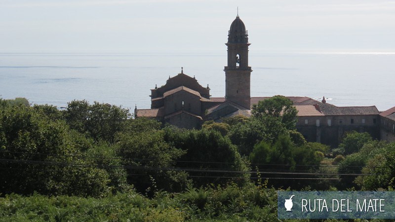
It took us a couple of hours to reach Oya, where we spotted in the distance the Royal Monastery of Santa María de Oya, founded in the 12th century.
We arrived in Mougás around 8 p.m., exhausted. We stayed at the first hostel we had on our list: Albergue O Aguncheiro, in Porto-Mougás.
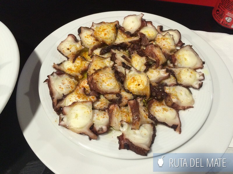
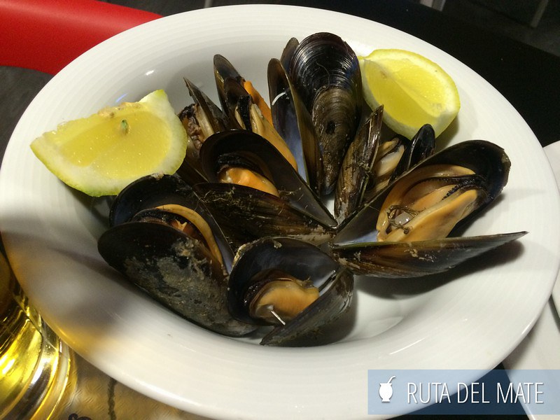
At the hostel’s restaurant, you can enjoy some Galician delicacies, like octopus or mussels.
From Mougás to Ramallosa – Stage 2
Things to do in Baiona
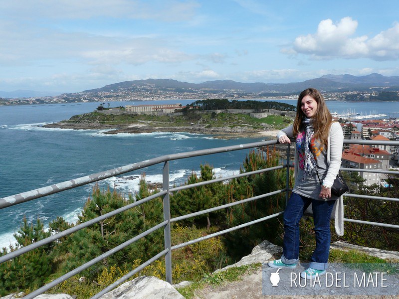
Baiona is a must-stop on the Portuguese Coastal Camino de Santiago. We arrived around midday, just in time for lunch, and headed straight to the port.
From there, we saw the Monterreal Castle, completed in the 16th century and now home to a Parador (a historic hotel).

Baiona’s port is of great historical importance, since Martín Pinzón arrived on these shores on the return from the first voyage to the Americas as captain of La Pinta. In the port, there is a replica of the caravel used by the explorers to cross the Atlantic.

Another highlight in Baiona is Mount Sansón, where the Virgen de la Roca is located. From here you can see the famous Cíes Islands in the distance. The Virgin is made entirely of stone, except for the hands and face, which are marble.
Things to do in Ramallosa
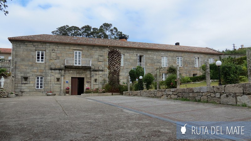
In Ramallosa we stayed at the Damas Apostólicas Hostel, also known as Pazo Pías. A pazo is an old 17th-century manor house, although due to the number of rooms it looks more like a small palace or monastery, which are in fact later modifications to the original building.
It only has single and double rooms, with private and shared bathrooms. It’s not the typical hostel with dormitories full of beds, but more like a “guesthouse.”
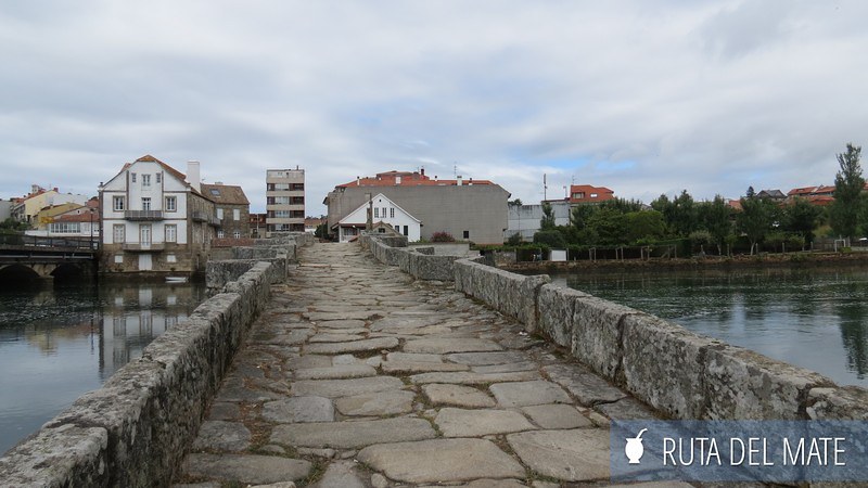
Ramallosa is divided in two: Santa Cristina to the south of the Miñor River and San Pedro to the north. There is a Roman bridge from the 13th century, still used today by pedestrians, next to a more modern bridge for vehicles.
It is said that near the bridge fertility rituals were performed for women who could not get pregnant.
Playa América, with its golden sand, is an ideal spot to relax and watch the sunset. Although the day began quite rainy, in the afternoon we enjoyed the excellent microclimate this area of Galicia is said to have.

From Ramallosa to Vigo – Stage 3
On this stage of the Portuguese Coastal Camino de Santiago, the path no longer runs by the coast, but through more rural landscapes. Along the way you’ll find the classic hórreos, very typical of northern Spain, especially Galicia and Asturias.
These structures were used for storing grains and cereals, with openings on the sides to allow air circulation, but elevated above the ground to avoid humidity.
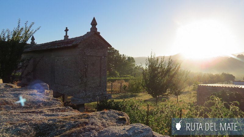
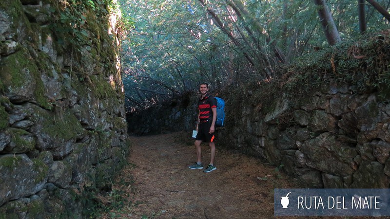
You’ll also pass through various ethno-archaeological areas, such as Saiáns and Muiños da Fraga de Gortade, with lush green tree-lined paths.
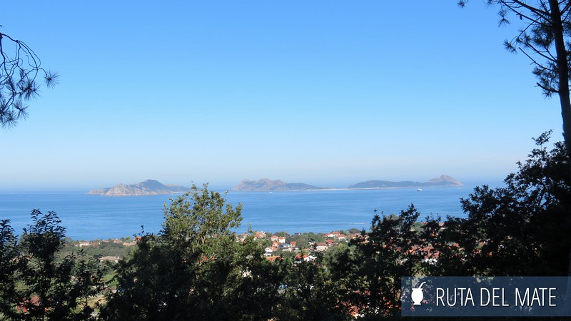
From time to time, you’ll catch sight of the Cíes Islands in the distance, part of the Atlantic Islands of Galicia National Park. Because of this, both the land and marine flora and fauna are protected.
A British newspaper named Rodas Beach, located in this archipelago, as one of the most beautiful beaches in the world, giving it worldwide fame.
But they’re not the only islands off the Galician coast. There’s also Ons Island, a bit less known but just as beautiful, where we decided to spend a couple of days after finishing the Camino.
The Camino de Santiago enters Vigo through the back door, along trails that turn into passages between factories, highways, and noise. But then our senses got some relief when we reached the Parque de los Castrelos and the Paseo del matemático Rufo Pérez, which follows a small stream. Locals use it for exercise or walking their dogs.

Visiting Vigo
Vigo welcomed us with enviable sunshine, as if happy we had arrived, and –spoiler– bid us farewell sadly with heavy rain.
Why does Vigo have a bad reputation? It’s often unfairly compared to its neighbors Santiago and A Coruña, and many visitors claim it’s a too industrial city.
We noticed that this is true, but it’s also what makes the city prosperous, and it’s the only non-provincial capital in Spain with the largest population (almost 300,000 inhabitants).
In Vigo there is no municipal pilgrims’ hostel, so you have to choose among the many accommodation options the city offers.
Alternatively, a couple of kilometers before reaching Vigo, there’s the O’Freixo hostel, run by the same person who manages a website with valuable Camino information (we mention and link it below).
We stayed right in the historic center, at the Hostal Real, run by a lovely lady, in a double room with shared bathroom.
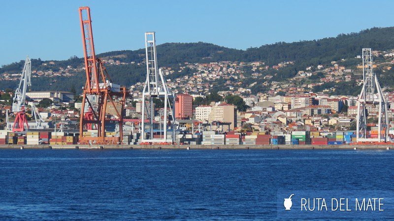
One of the must-see spots in the city is the Port of Vigo, from where many Spaniards (especially Galicians) departed for Argentina in search of new opportunities. In the distance, we could see the cranes, containers, and shipyards that somewhat spoil the landscape.
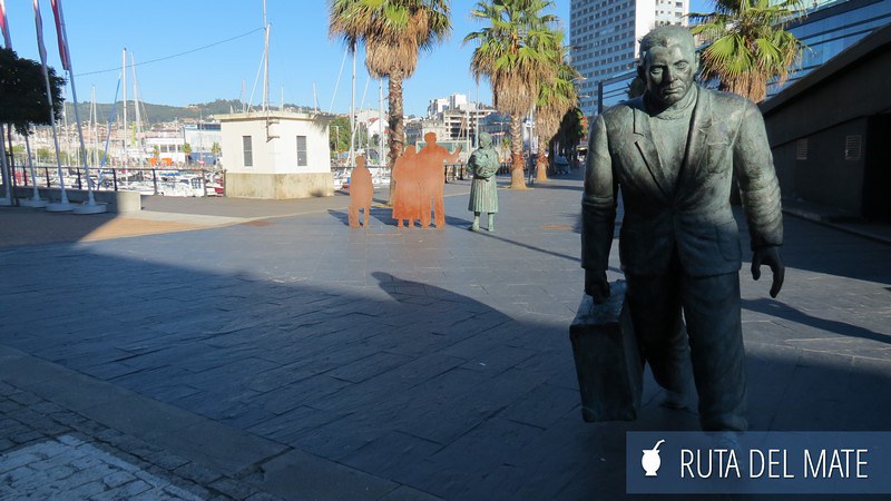
At the Vigo Cíes Port, from where ferries depart for the Cíes Islands, you’ll find the A Laxe Shopping Center, a small marina, and a very moving sculpture in honor of those who had to emigrate, leaving their families and homeland behind.
I sent a photo of the sculpture to Alejandra from Viajar Cueste lo que Cueste, who at the same time as us was walking the French Camino from Sarria with her 74-year-old father. Her reply chilled me: Pepe (her dad) had actually departed for Argentina from that very spot back in the 1950s.
Galicians have been emigrating to Argentina since the 19th century for various reasons, but by the mid-20th century, the number of people increased due to the Spanish Civil War. Many left Spain not only to escape political repression but also hunger and lack of work.
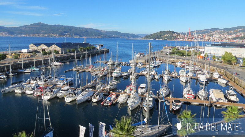
We continued strolling around the port and entered the A Laxe Shopping Center. We went up to the top floor to enjoy views of Vigo and the port from above and took advantage of the bridge connecting it with the Casco Vello (old town) on the upper side of the city.
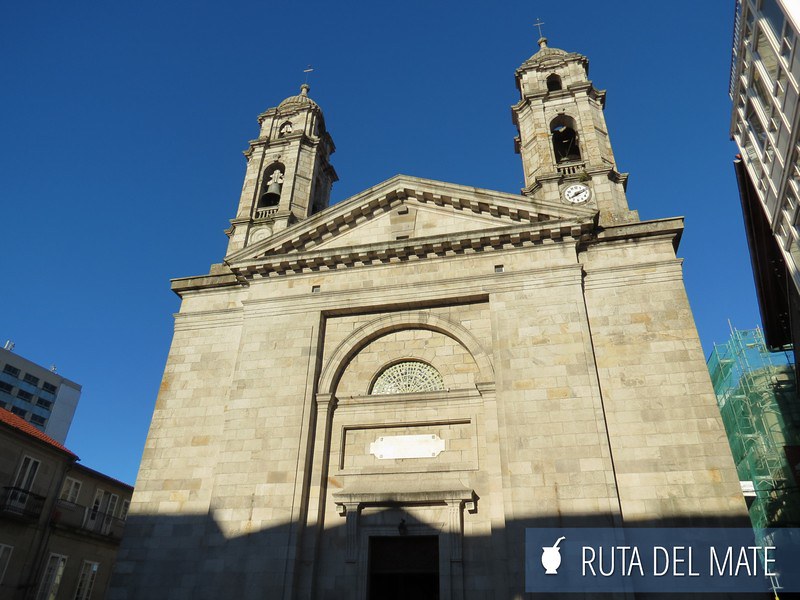
Soon after, we arrived at the co-cathedral of Santa María de Vigo, meaning it has cathedral status but shares it with another temple — in this case, with the Cathedral of Tui.
Although its construction was completed in the early 19th century, it stands on the site previously occupied by other religious temples dating back to the 12th century.
We kept wandering through the narrow streets until we reached the Plaza de la Constitución, named for being the place where the Spanish Constitution of 1812 was first read in Vigo. Among the many buildings, we spotted the old Town Hall.
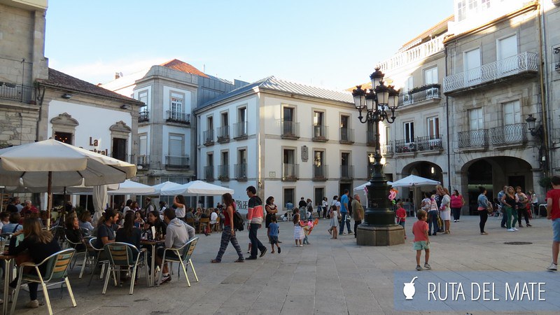
At the intersection of Policarpo Sanz and Elduayen streets, you’ll find the Plaza del Sol and Plaza de la Princesa, home to two curious monuments: El Sireno, by Francisco Leiro, and Dinoseto — a plant sculpture shaped like a dinosaur and a beloved character among locals.
But Vigo has many more scattered sculptures, such as the one dedicated to Galician emigrants, another with horses at one of the city’s entrances, one to the octopus, another to the crab, to Jules Verne, and to other local figures.
Vigo has much more to offer if you have more time than we did — since we were following a set pilgrim route. For example, climbing to the various viewpoints around the city like Monte A Guía or Monte O Castro, where, as the name suggests, you’ll find the remains of ancient Celtic settlements.
From Vigo to Redondela – Stage 4
Although it wasn’t raining, low clouds still hovered over the estuary and the bateas, those floating platforms used for shellfish farming.
The wild scenery was still hiding from us as we had to leave Vigo’s metropolitan area to climb into the hills and small villages.

Visiting Redondela
In Redondela, the Portuguese Coastal Camino merges with the central or traditional route, so there is a greater choice of accommodation.
The municipal pilgrims’ hostel is the first you come across. It’s located in a building that was once a Renaissance manor house.
As expected, we didn’t find available beds there, so we looked for other hostels. There are several pilgrim hostels in town, such as Casa da Torre, A Conserveira, and A Rotonda.
From Redondela to Pontevedra – Stage 5
Once this stretch joins the Traditional Portuguese Camino, everything is better signposted.
On the way, you’ll reach the mouth of the Verdugo River into the Vigo estuary, and to cross it, you’ll use the Roman Bridge of Sampaio.
This bridge is historically significant because in 1809 a battle between Spaniards and French troops took place here during the Peninsular War.
By partially destroying the bridge, the Spaniards prevented Napoleon’s troops from advancing south into Galicia, forcing them to retreat — not only from here but from all of Galicia.
Practical Information for Your Portuguese Coastal Camino
Useful Tips for Walking the Portuguese Coastal Camino
When it comes to the Portuguese Camino — and especially the Coastal Route — we found few websites with information, but the little there is provides very valuable resources.
The one that helped us the most was Luis do Freixo’s website, with interactive maps that we printed beforehand so we wouldn’t get lost, as well as information on hostels, places to eat, and Camino history.
In fact, Luis also runs a hostel before reaching Vigo, where pilgrims can rest instead of entering the city.
For our part, we wrote an article with the tips that came to mind based on the times we’ve walked the Camino.
➔ Link to our Camino de Santiago articles.
What you need for your trips to Europe
Plan your journey easily with these trusted resources: